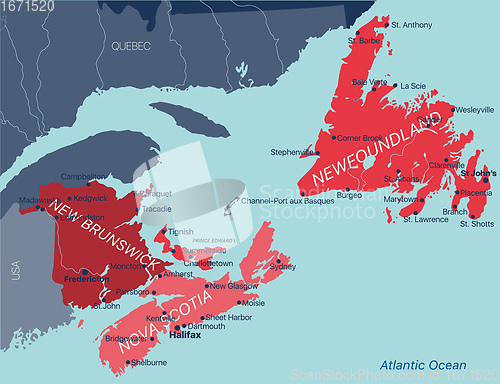
Vector color editable map of Atlantic provinces of Canada New Brunswick, Nova Scotia, Prince Edward Island and province of Newfoundland
Image Id 5170533 - Image cost 1 download credit - Jpeg image
Photographer/Copyright: Ruslan Olinchuk
Specifications
File size
2.79 MB (Megabyte)
File type
Jpeg/RGB
Dimensions
(width) 6500 px (height) 4996 px
Megapixle size
32.5 Mp
Print size at 300DPI
55.03 x 42.3 cm
Orientation
Horizontal
Description
Vector color editable map of Atlantic provinces of Canada New Brunswick, Nova Scotia, Prince Edward Island and province of Newfoundland with capitals, national borders, cities and towns, rivers and lakes. Vector EPS-10 file
Link to this image: www.ScanStockPhoto.com/view_image.php?image=5170533
